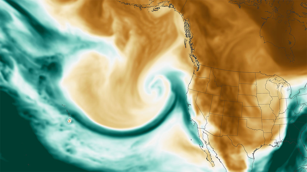
“Atmospheric river” may sound airy and delicate. In fact, the term describes massive, fast-moving storms that can hit as hard as a freight train. Some unleash huge, flooding downpours. Others can quickly bury towns under a meter or two (up to six feet) of snow.
These long, narrow bands of condensed water vapor form over warm ocean waters, often in the tropics. They can often reach 1,500 kilometers (930 miles) long and be one-third that wide. They’ll snake through the sky like giant rivers, transporting huge amounts of water.
On average, one atmospheric river can transport up to 15 times the volume of water leaving the mouth of the Mississippi River. When these storms arrive over land, they can drop much of their moisture as drenching rains or mega snowfalls.
Marty Ralph at the University of California, San Diego, knows a lot about these rivers in the sky. He works as a meteorologist at the Scripps Institution of Oceanography. Atmospheric rivers can bring welcome water to a parched region. However, Ralph adds, they also are “the primary, almost the exclusive” cause of floods on the U.S. West Coast.
That was hammered home from December 2022 into early 2023. During this period, a seemingly relentless barrage of atmospheric rivers hit the U.S. and Canadian West Coasts. Just in December and January, nine atmospheric rivers slammed the area back to back. More than 121 billion metric tons (133 billion U.S. short tons) of water fell on California alone. That’s enough water to fill 48.4 million Olympic-size swimming pools!
Yet big as they are, these storms can be surprisingly tough to see coming. A week’s warning is about the best that forecasters can now give.
But Ralph and others are working to change that.
Studying those high-flying rivers
Ten years ago, Ralph was part of a team at Scripps that created the Center for Western Weather and Water Extremes, or CW3E for short. Today Ralph directs this center.
It created the…
Read the full article here


