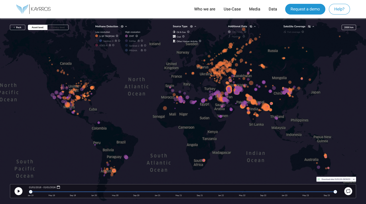
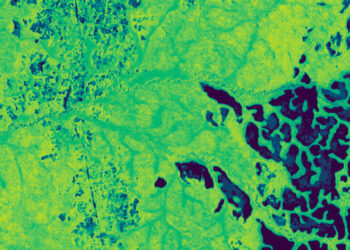
TAMPA, Fla. — French satellite imagery analysis provider Kayrros launched a free version of its global methane tracking map Nov. 29 to help hold governments and businesses to account for their emissions.
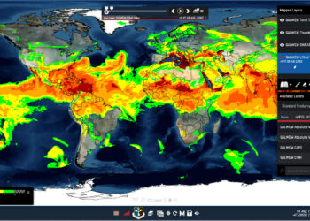
The public platform uses data from the European Space Agency’s Sentinel-5P satellite and a sensor on the International Space Station to provide daily snapshots of the greenhouse gas, a major cause of global warming.
The map shows 5,645 methane super-emitters worldwide, or sources that release the gas at a significantly higher rate than is typical. Of these, 3,320 are from oil and gas, 874 from coal, and 1,451 from waste and agriculture.
Among the big offenders is the Amman landfill in Jordan that Kayrros says produces as much greenhouse gas a year as 450,000 cars, despite investment from the European Union to improve gas capture and electricity generation.
Kayrros is calling for an outright ban on super-emitters, saying rapid cuts in methane emissions from fossil fuels alone would have the same effect on curtailing rising temperatures as taking all cars and trucks off the road.
Reducing major methane emissions would be a relatively easy way to tackle climate change, according to Kayrros president and co-founder Antoine Rostand.
The methane map comes on the eve of the annual United Nations Climate Change Conference, COP28, which will see diplomats discuss measures in Dubai between Nov. 30 and Dec. 12 for limiting global warming.
“With COP28 on the horizon, and methane reduction as a key focus of the conference, we are taking advantage of increased public awareness of and interest in this devastating greenhouse gas,” Rostand said.
The company also provides access to data from other satellites that is exclusively available through commercial agreements, in addition to more granular analysis as part of paid studies, such as on countries, cities, and individual fields.
The United Nations Environment Program’s…
Read the full article here
