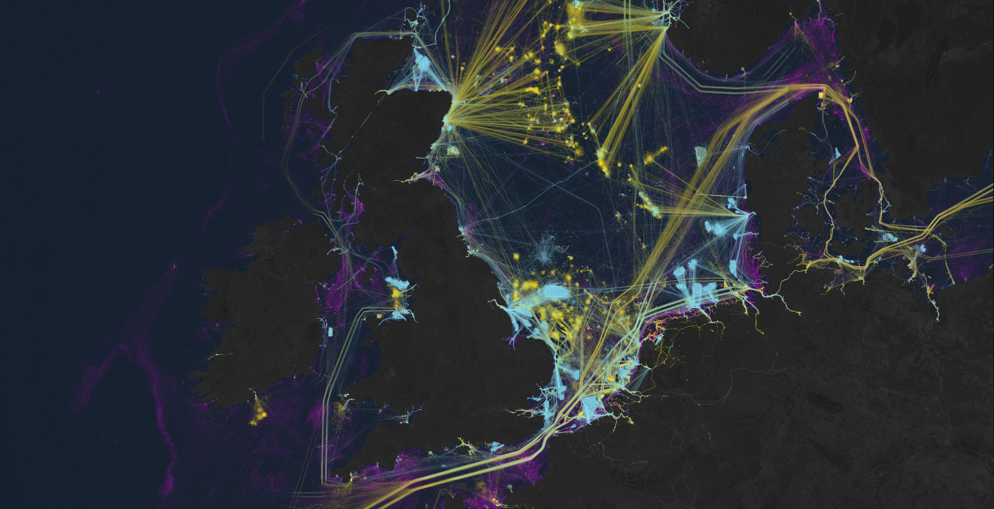
Researchers can now access artificial intelligence analysis of global satellite imagery archives for an unprecedented look at humanity’s impact and relationship to our oceans. Led by Global Fishing Watch, a Google-backed nonprofit focused on monitoring maritime industries, the open source project is detailed in a study published January 3 in Nature. It showcases never-before-mapped industrial effects on aquatic ecosystems thanks to recent advancements in machine learning technology.
The new research shines a light on “dark fleets,” a term often referring to the large segment of maritime vessels that do not broadcast their locations. According to Global Fishing Watch’s Wednesday announcement, as much as 75 percent of all industrial fishing vessels “are hidden from public view.”
As The Verge explains, maritime watchdogs have long relied on the Automatic Identification System (AIS) to track vessels’ radio activity across the globe—all the while knowing the tool was far from perfect. AIS requirements differ between countries and vessels, and it’s easy to simply turn off a ship’s transponder when a crew wants to stay off the grid. Hence the (previously murky) realm of dark fleets.
“On land, we have detailed maps of almost every road and building on the planet. In contrast, growth in our ocean has been largely hidden from public view,” David Kroodsma, the nonprofit’s director of research and innovation, said in an official statement on January 3. “This study helps eliminate the blindspots and shed light on the breadth and intensity of human activity at sea.”
[Related: How to build offshore wind farms in harmony with nature.]
To solve this data void, researchers first collected 2 million gigabytes of…
Read the full article here

