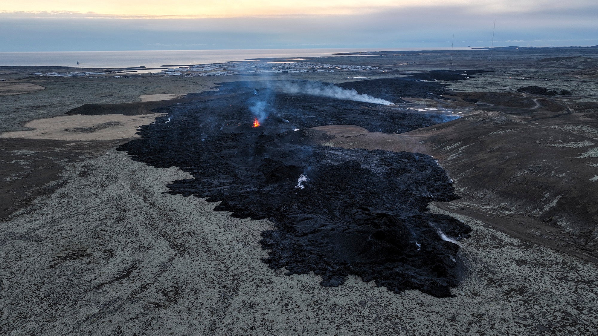
Lava flows in southwestern Iceland appear to be slowing down, after the second volcanic eruption in one month on January 14. Molten lava destroyed multiple homes in the town of Grindavík, which had been evacuated hours before. There is no danger to the rest of the island, home to roughly 380,000 people and 33 active volcano systems.
[Related: How the Tonga eruption rang Earth ‘like a bell’]
Iceland sits over the Mid-Atlantic Ridge, the boundary between the Eurasian and North American tectonic plates. The country averages about one volcanic eruption every four to five years. The most disruptive eruption in recent times was the 2010 eruption of the Eyjafjallajokull volcano. Enormous clouds of ash spewed into the atmosphere, disrupting air travel across the Atlantic Ocean for months. This eruption is not expected to push large quantities of ash into the air and operations at Keflavík Airport are continuing as normal.
According to Iceland’s Meteorological Office (IMO), it is still too soon to officially declare the danger from this most recent eruption over and difficult to estimate how long it will last. The IMO said that their GPS sensors continued to detect that the magma conduit beneath Grindavík is expanding in the area. Thermal drone images taken show that the fissures previously mapped southwest of Grindavík have enlarged and considerable hazards still remain in the area.
Following the eruption, a series of earthquakes began at 3:00 a.m. local time near Sundhnúksgígar. The earthquakes then migrated southwest towards Grindavík. This seismic swarm opened a lava-spewing fissure by 8 a.m. The fissure spread to within 3,000 feet of the fishing town, which is about 30 miles southwest of the capital city Reykjavik. By noon, another fissure had opened north of Grindavík.
Icelandic University volcanologist Þorvaldur Þórðarson, told the Iceland Monitor that eruptive activity shifted from the upper fissure and is creeping…
Read the full article here


