Landslides can be truly devastating, killing people and animals that can’t get out of the way in time and washing away property. Landslides generally occur during earthquakes, volcanic eruptions, or massive rainfall that make a sloped section of land like a cliff unstable. Now, a team from the University of Alaska Fairbanks (UAF) have developed a new method that could be used to remotely detect large landslides within minutes and tell if the slide is a tsunami hazard. Their method is described in a study published February 9 in the journal The Seismic Record.
[Related: California wildfires may give way to massive mudslides.]
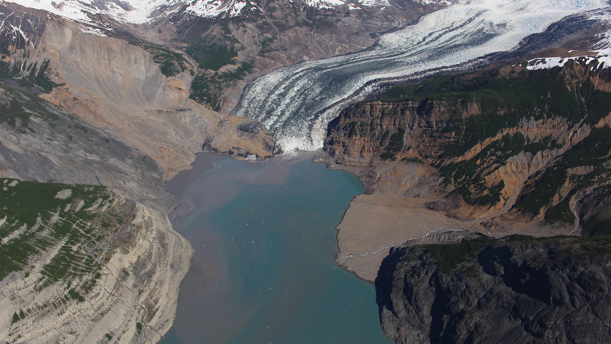
Monitoring Alaska’s glacial fjords for danger
The study cites a 2015 landslide that sent 100 million cubic yards of rock into Alaska’s Taan Fjord. It generated a tsunami that stripped vegetation as high as 620 feet above the waterline.
In response, the team helped develop a prototype system capable of real-time detection that has been in place since August 2023 around the Barry Arm section of Prince William Sound. The system uses data from seismic stations already in Alaska’s monitoring network.
State and federal disaster agencies worry that a landslide and tsunami could occur at Barry Arm. The Barry Glacier has significantly retreated and left behind an unsupported fjord wall, or the slope of rock or ice rising up from the water to the top of the landmass. Over the past several years, the wall has slumped about 650 feet. Additional analysis of seismic station data on the region revealed that three landslides occurred in 2020 and 2021.
“The warming climate is causing glaciers to retreat, leaving behind valleys whose mountainsides and hillsides have lost their support,” UAF research seismologist Ezgi Karasözen said in a statement. “This is important, especially in regions like southern coastal Alaska, because huge masses of land can and do spill into water and cause tsunamis.”
According to…
Read the full article here


