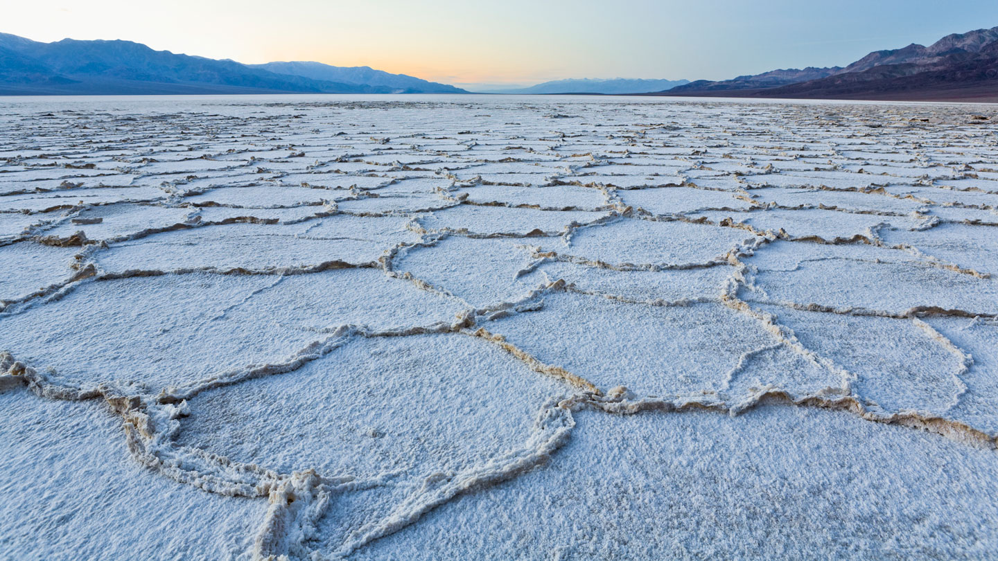
From Death Valley to Chile to Iran, similarly sized polygons of salt form in playas all over the world — and subterranean fluid flows might be the key to solving the long-standing puzzle of why.
Geometric shapes such as pentagons and hexagons spontaneously form in a wide range of geologic settings. Dried mud, ice and rock often crack into polygons, but these patterns tend to vary dramatically in size.
So why are all playas so persistently similar? The answer lies underground, physicist Jana Lasser and colleagues propose February 24 in Physical Review X. With sophisticated mathematical models, computer simulations and experiments performed at Owens Lake in California, the team connected what they saw on the surface with what is going on beneath.
“Fluid flows and convection underground are uniquely able to explain why the patterns form,” says Lasser, of the Graz University of Technology in Austria.
This 3-D approach was key to explaining the universality of salty polygons.
Salt flats form in places where rainfall is scarce and there’s a lot of evaporation (SN: 12/5/07). Groundwater seeping up to the surface evaporates, leaving a crust of salts and other minerals that had been dissolved in the water. Most striking, this process results in low ridges of concentrated salt that divide the playa into polygons: mostly hexagons with a smattering of pentagons and other geometric shapes.
The type of salt varies from one playa to another. Table salt, or sodium chloride, dominates in some playas, but others have more sulfite salts. And the salt crusts themselves range in thickness from a few millimeters to several meters. That variation seems to be why previous attempts to describe the playas’ patterns failed.
Whether the crusts are meter- or millimeter-thick, salt pans feature polygons that are 1 to 2 meters across. Previous models based on cracking, expansion and other phenomena that describe how mud and rock fracture instead…
Read the full article here


